Peterborough’s growth from a lumber town on the Otonabee River to a regional manufacturing hub has left a patchwork of fill and natural deposits that complicate foundation design. Much of the city sits atop Paleozoic limestone of the Simcoe Group, yet the overburden—shaped by the Wisconsinan glaciation—varies from dense lodgement till in the east end to soft glaciolacustrine silts near Little Lake. When a developer proposed a mid-rise on Water Street, the borehole logs revealed six meters of compressible clay above the till, a sequence that required reliable blow counts to size footings and avoid differential settlement. Our team runs the Standard Penetration Test following ASTM D1586, delivering N-values that feed directly into bearing capacity models and liquefaction assessments under the National Building Code of Canada. For projects where continuous profiling is needed, we often pair SPT sampling with a CPT sounding to capture thin silt seams that split-spoon intervals might miss.
In Peterborough’s glaciated terrain, an uncorrected SPT N-value can overstate soil strength by 30 percent—hammer energy calibration is not optional.
Scope of work in Peterborough Ontario
Demonstration video
Critical ground factors in Peterborough Ontario
The most frequent mistake we encounter on Peterborough sites is running SPT borings without energy calibration and then plugging raw N-values into liquefaction spreadsheets. A doughnut hammer on an old CME-45 rig can deliver as little as 45 percent of theoretical energy, which inflates blow counts and masks loose, potentially liquefiable sand lenses in the till. Under the NBCC 2020 seismic provisions, Peterborough falls within a moderate seismicity zone, and the glaciolacustrine sands mapped along the Otonabee valley warrant screening for cyclic softening if the water table is within three meters of grade. Skipping energy correction—or worse, terminating borings at six meters when the code requires investigation to ten meters for Seismic Category C structures—creates a compliance gap that no structural engineer can close after the fact.
Our services
Our Peterborough SPT work is integrated into a broader geotechnical scope, ensuring that blow-count data is interpreted alongside complementary lab and field results.
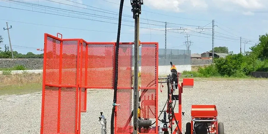
SPT Borehole Drilling
Hollow-stem auger drilling to depths of 10 to 30 meters with split-spoon sampling at 1.5 m intervals, logged by an experienced geotechnical technician familiar with the Peterborough drumlin and spillway stratigraphy.
Energy-Calibrated SPT
Every rig run in the Peterborough area is instrumented with a load cell and accelerometer to record transferred energy, allowing us to report N₆₀ values corrected to 60 percent efficiency per ASTM D4633.
Liquefaction Screening Package
SPT data combined with grain-size distribution and Atterberg limits to run Seed-Idriss simplified procedure and Boulanger-Idriss (2014) triggering analysis for NBCC compliance.
Common questions
How much does SPT testing cost for a residential lot in Peterborough?
For a typical single-family residential site requiring one borehole to eight meters depth, the SPT investigation ranges from CA$710 to CA$1.120, including mobilization within the Peterborough urban area, hollow-stem auger drilling, split-spoon sampling at 1.5 m intervals, and a factual report with corrected N₆₀ values.
How many boreholes does the Peterborough building department require?
The City of Peterborough generally follows the Ontario Building Code, which references the CFEM for geotechnical scope. For a single-family dwelling, one borehole may suffice if subsurface conditions are uniform; for multi-unit buildings or lots with known fill, two to three boreholes are standard. We confirm requirements during the permit review stage.
What depth do you drill for SPT testing in the Kawarthas?
Borehole depth depends on the structure and soil profile, but in the Peterborough area we typically extend borings until refusal on limestone bedrock or to at least 1.5 times the foundation width below footing elevation. In the deeper till plains north of the city, 15 to 20 meters is common; near the Otonabee River, bedrock may be encountered at 3 to 6 meters.
Is SPT data enough to evaluate liquefaction risk on my site?
SPT N-values form the backbone of liquefaction screening under the NBCC 2020, but they should be supplemented with grain-size analysis and Atterberg limits to confirm the soil is susceptible. Sands with more than 15 percent fines behave differently from clean sands, and the SPT alone cannot provide that distinction. We package the SPT with lab testing to deliver a complete screening report.