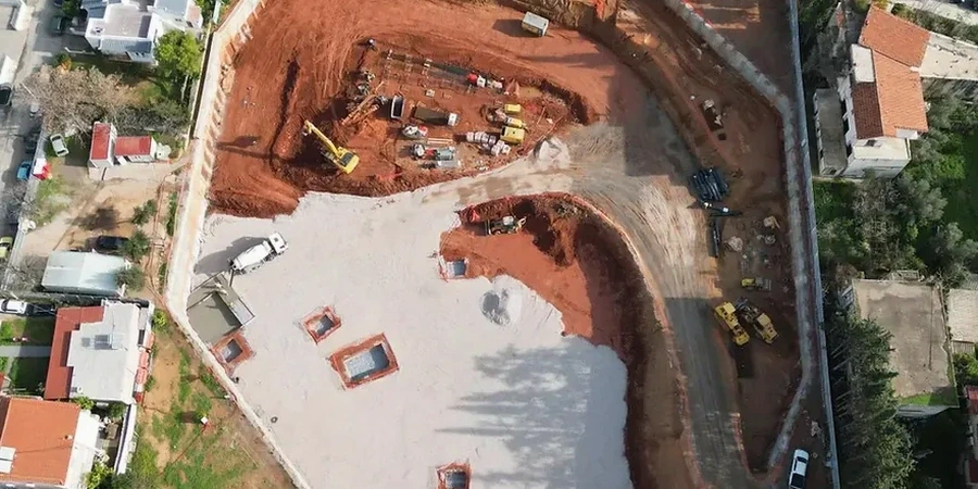
Working under the National Building Code of Canada (NBCC) and CSA A23.3 means every deep excavation in Peterborough starts with a proper understanding of what's underground. And around here, that's rarely straightforward. The city sits on a paleozoic limestone plain draped with glacial till and pockets of silt, so you hit rock at six metres in one lot and soft clay at twelve in the next. We've seen projects near the Otonabee River where the water table sits barely two metres below grade, and that changes everything: lateral earth pressures, dewatering strategy, basal heave risk. Before we sketch a single shoring section, we run lab tests on Shelby tube samples and correlate them with field data from CPT testing to build a ground model that actually reflects the variability you'll encounter during construction.
Peterborough's limestone isn't just 'rock'—it's fractured, weathered, and interacts with groundwater in ways that make every shoring design a custom problem.
Scope of work in Peterborough Ontario
Critical ground factors in Peterborough Ontario
The Ordovician limestone underlying Peterborough isn't a uniform mass—it's jointed, occasionally karstic, and the upper two metres are often weathered to a rubbly, clay-filled horizon that behaves more like soil than rock. When an excavation bottoms out in that transition zone, basal instability becomes a real concern, especially if dewatering pulls fines out of open fractures. In one project near the Trent University campus, groundwater inflow through a solution channel in the Lindsay Formation limestone tripled the pumping rate overnight and nearly compromised a sheet pile wall toe. We design for that reality: we specify filter criteria based on gradation curves from our lab, model seepage forces in PLAXIS, and size sump capacity with enough redundancy to handle a sudden fracture intercept. In the deeper overburden north of the city, soft clay layers can trigger time-dependent lateral movements if the excavation stays open too long—so we calculate staged excavation sequences and set movement thresholds for inclinometer monitoring.
Our services
Every deep excavation design we deliver comes out of the same workflow: site investigation, lab testing, numerical modelling, and construction-stage monitoring. Here's what that looks like on a typical Peterborough project.
Shoring system design and analysis
We design soldier pile and lagging walls, secant pile walls, and tied-back systems using site-specific lab data—not textbook values. Our analysis covers global stability, basal heave, and seismic load cases per NBCC 2020. For excavations deeper than 6 m in overburden, we run finite element models (PLAXIS 2D) to capture soil-structure interaction, and we verify anchor bond lengths in limestone with pull-out test correlations calibrated to our lab's UCS results.
Dewatering and groundwater control plans
Peterborough's shallow bedrock and seasonal high water table make dewatering the make-or-break part of most deep digs. We design wellpoint systems, deep sump arrangements, and cut-off walls based on in-situ permeability tests and lab grain-size curves. Our plans account for fracture flow in limestone—something standard soil mechanics handbooks miss—and include contingency triggers for sudden inflow events like the ones we've documented in the Lindsay Formation.
Common questions
What does geotechnical design for a deep excavation typically cost in Peterborough?
For a complete design package—including site investigation review, lab testing coordination, shoring design calculations, dewatering plan, and construction-phase monitoring specifications—budgets in the Peterborough area generally run between CA$3,100 and CA$11,020. The spread depends on excavation depth, proximity to the Otonabee River, bedrock variability, and whether you need 2D finite element analysis or can work with limit-equilibrium methods. A straightforward single-level cut in shallow limestone falls on the lower end; a multi-level excavation in thick overburden with tied-back walls and staged dewatering sits on the higher end.
How do you handle the transition zone between overburden and weathered limestone in the shoring design?
We treat it as a distinct layer with reduced strength parameters—not as competent rock. Our lab runs point-load tests across the transition zone and we correlate those with full UCS tests to define a strength profile that degrades from intact limestone to clay-infilled rubble. In the shoring model, that zone gets assigned lower Ko values and we extend the wall embedment below the weathered horizon into competent rock. If the transition is saturated, we add a drainage blanket behind the lagging and design the passive resistance assuming softened conditions.
Which NBCC seismic provisions apply to deep excavation design in Peterborough?
Peterborough falls in a low-to-moderate seismic hazard region with a PGA around 0.04–0.06g per NBCC 2020. For most deep excavations, seismic earth pressures don't govern the design—static and groundwater conditions do. But we still check the pseudo-static case (kh = 0.5 × PGA) for anchored walls and cantilever stages, and we verify that liquefaction isn't a concern in the loose silty sand lenses that occasionally appear in the overburden north of Parkhill. If the excavation stays open through a winter freeze-thaw cycle, we also factor in the temporary strength loss in the upper two metres.
What monitoring do you recommend during excavation near existing buildings in downtown Peterborough?
We spec inclinometers behind the shoring wall, optical survey points on adjacent foundations, and standpipe piezometers to track groundwater drawdown—especially within the zone of influence of any dewatering system. For excavations deeper than six metres within fifteen metres of a heritage building (and Peterborough has plenty of those downtown), we add vibration monitoring during rock hammering or drilling. Thresholds are set based on pre-construction condition surveys and we tie them to a traffic-light action plan: green, amber, red with predefined response measures at each level.