Peterborough sits at 195 meters elevation on a complex mix of limestone plains and glacial drumlins. With a population exceeding 83,000 in the metro area, development constantly pushes into varied soil profiles where overburden thickness can range from zero at rock outcrops to over 30 meters in buried bedrock valleys. Understanding what lies beneath the surface before excavation or foundation design is not optional here. Vertical Electrical Sounding (VES) delivers that subsurface profile by measuring apparent resistivity at depth. The method distinguishes saturated till from dry sand, identifies karst features in the limestone, and locates the bedrock interface that dictates pile design. For any project near the Otonabee River or the Trent-Severn Waterway, where groundwater interaction is constant, electrical resistivity surveys become a critical planning tool that prevents budget overruns tied to unexpected ground conditions. This technique works by injecting current into the ground and measuring voltage differences, building a layered model of soil and rock resistivity. The data directly informs excavation planning, dewatering requirements, and foundation type selection across Peterborough’s four-season construction window.
A VES survey in Peterborough can distinguish saturated glacial till from clean sand aquifer layers in a single afternoon of field work.
Scope of work in Peterborough Ontario
Critical ground factors in Peterborough Ontario
Peterborough’s humid continental climate produces a pronounced spring thaw that saturates overburden soils from March through May. This seasonal saturation dramatically reduces soil resistivity values, which can mask the true contrast between clay layers and water-bearing sand if surveys are conducted during wet periods. Conversely, late-summer drought conditions in August drive resistivity values upward, sometimes creating false bedrock signatures in dry clay. The technical team schedules VES work around these extremes, correlating resistivity data with available borehole logs from past grain size analysis to calibrate the geoelectric model. The risk of misinterpreting a perched water table as the main aquifer carries real cost implications—dewatering a site designed for shallow groundwater when the true water table sits 5 meters deeper. Karst features in the shadow of the limestone plain add another layer of uncertainty; a resistivity low could indicate a clay-filled sinkhole rather than a continuous till layer. Cross-referencing VES results with local well records and surficial geology maps from the Ontario Geological Survey minimizes these interpretation risks before shovels hit the ground.
Our services
The electrical resistivity program in Peterborough covers two distinct but complementary service tiers, each designed for specific project scales and investigation objectives.
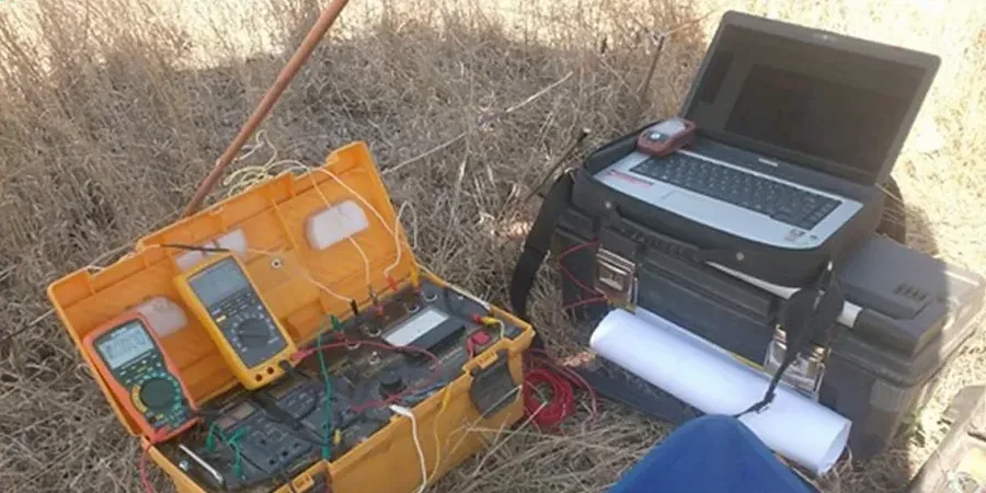
Single-Point VES Sounding
One vertical electrical sounding at a specified location. This service targets projects where the main question is bedrock depth or groundwater table elevation at a single building footprint. The crew deploys the Schlumberger array, acquires data through a full expansion cycle, and delivers a 1D resistivity model with interpreted lithology. Typical turnaround is four business days. Best suited for residential additions, small commercial pads, and preliminary site screening.
Multi-Sounding Site Characterization
Multiple VES points arranged on a grid or transect across the property. This approach builds a pseudo-2D resistivity profile that reveals lateral changes in overburden thickness and identifies buried channels or karst zones. The field work spans one to two days depending on site size. The final report correlates all soundings into cross-sections, providing a continuous subsurface model for engineers designing foundations, stormwater infiltration systems, or excavation support in Peterborough's variable glacial terrain.
Common questions
What depth can a VES survey reach in the Peterborough area?
The maximum investigation depth depends on the maximum current electrode spacing and local ground resistivity. In Peterborough's glacial overburden, a standard Schlumberger array with AB/2 spacing of 150 to 200 meters typically resolves layers down to between 45 and 60 meters. This reach covers most practical construction depths, including deep pile sockets into limestone bedrock. For deeper targets, the team extends the transect or supplements with alternative methods.
How long does a VES survey take, and what access do you need?
A single-point sounding takes two to three hours of field time, including setup, data acquisition, and demobilization. Multi-point campaigns run one to two full days. The crew needs a clear linear strip roughly 5 meters wide and up to 200 meters long, free of buried metallic utilities that interfere with current injection. Downtown Peterborough sites with limited space can use shorter transects with reduced maximum depth.
What does an electrical resistivity survey cost for a project in Peterborough?
Single-point VES soundings in Peterborough range from CA$880 to CA$1,600 depending on target depth and site access conditions. Multi-sounding grid programs are quoted on a project basis. The price includes field data acquisition, inversion processing, interpreted cross-sections, and a signed engineering report suitable for permit submission.